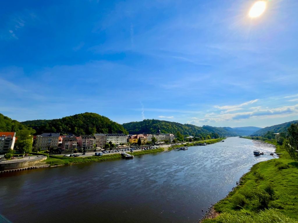
The old road that leads to the village is lined with apple trees in full blossom. The sky is blue and the sun shines down on us as we walk, but the air is still cool in the shade and this morning, as we waited for the train in Berlin, we wore woolly hats and cradled cups of coffee to keep our hands warm. From Bad Schandau station we climbed steeply up the side of the river valley until we were high above the Elbe and onto a plateau where we caught our first glimpse of the painted ‘M’ that told us we had reached the trail. Berlin, and our normal lives, suddenly feels a long way away.
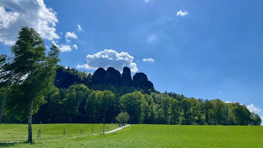
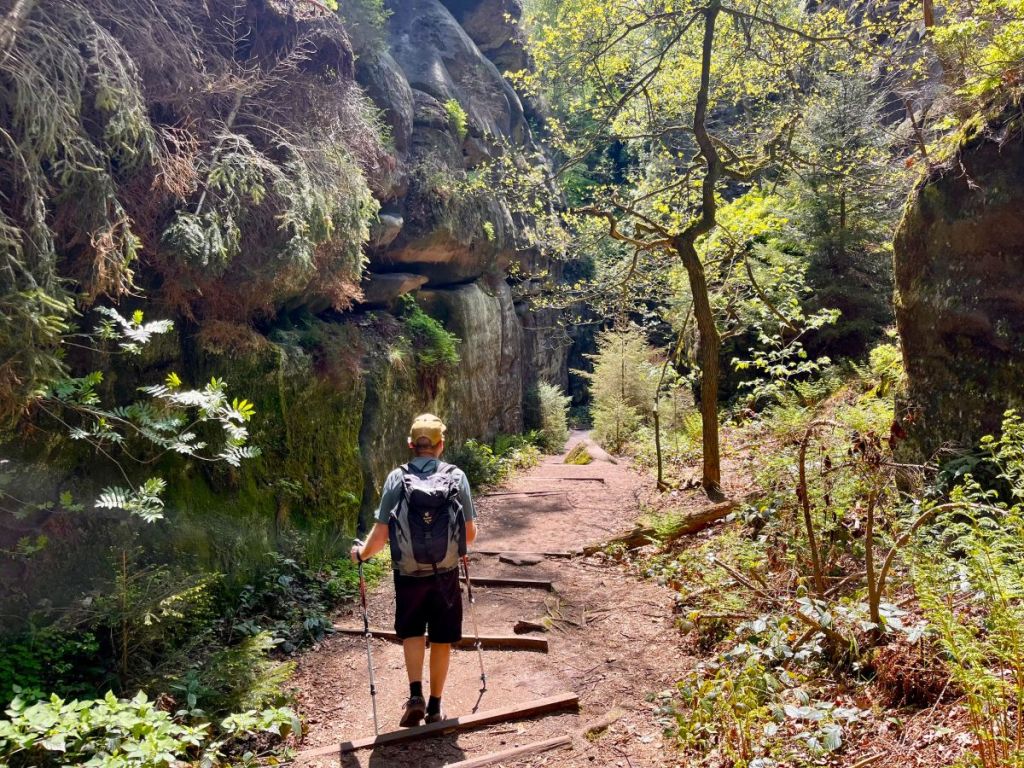
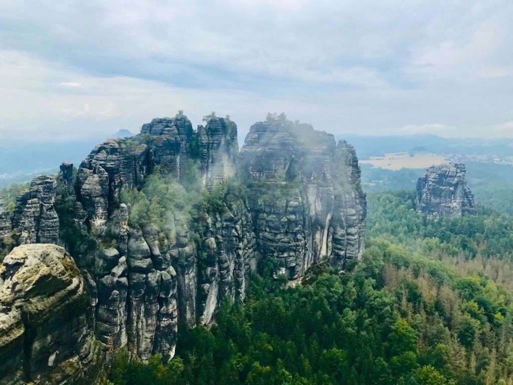
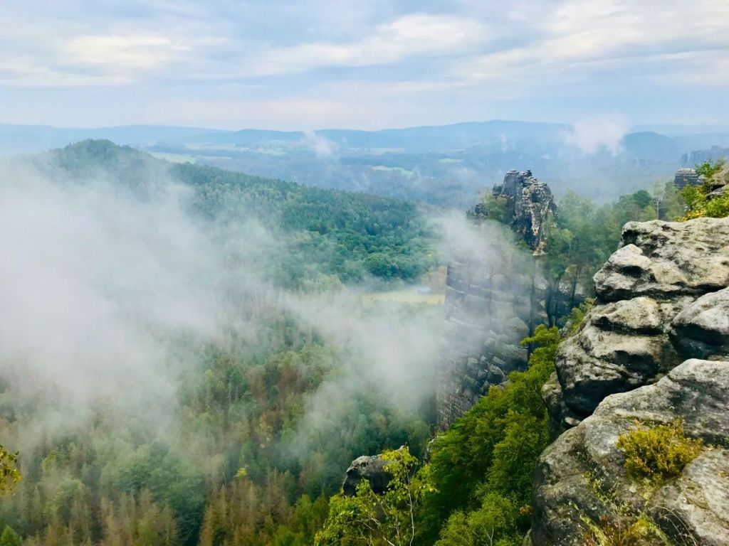
We walk alongside fields where the hedgerows are slowly coming to life after the long winter with the forest waiting for us ahead. We’ve already seen the first of the towering rock formations, the sandstone towers that reach up high above the treetops, from the train window and now we can see the rocks of the Papststein ahead of us. The route takes us through narrow gorges and up some ladders, until we top out with a view that unfolds to the north and the east. Rock pillars and mixed forests. Fields of yellow and green. The deep blue of the sky. Despite the early morning cold, springtime is here, and we have stripped down now to t-shirt and shorts.
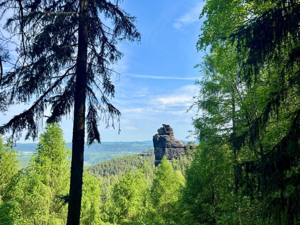
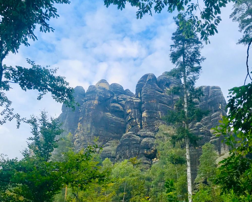
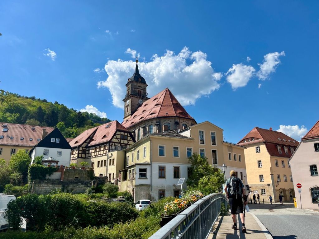
A few hours later we emerge from the forest that has surrounded us since we dropped down from the top of the Papststein and we can look down and out across the rooftops of a village that sits in a hollow between where we stand at the Pfaffenstein, a table hill guarded by tall trees, that is to be our final ascent of the day. This is a place famous for rock climbing, Saxon-style of course, without chalk or metal protection. Its caves and crevices have been a hideout for centuries. A place to escape the outside world.
But the world has been coming to Pfaffenstein for a while now. One of the mountain crags features a marble plaque dedicated to Carl Gottlob Jäckel, pioneer of tourism here back in the 19th century. He opened the first inn in a cattle stall in 1852, and there is a hilltop restaurant on the site to this day. The beer garden is doing a good trade, despite it being a midweek day in April, but we find a quiet spot out on the rocks to look out across the fields and forests, and eat our sandwiches.
If you grow up walking in places with constant vistas, whether the moorlands of northern England or the sheep-shorn hills of Wales, Alpine meadows or above the treeline wherever in the world you put one foot in front of the other, you have to get used to walks where the views are earned and fleeting, before the forest claims you in its embrace once more. It’s not worse. It’s not better. It’s just different. And today, the views are worth every step in the woods and every ladder climbed in order to attain them.
From where we sit we can spot the other table hills and rocky outcrops of Saxon Switzerland, on both sides of the Elbe. We tell each other stories of previous visits, of previous walks. Share memories of this place at different times of the year and different times in our lives. How wonderful it is that a place so beautiful is so close to home. We should come here more often, we tell ourselves. We certainly should. But now we’ve got to get back down to the river and to the station, to catch the train back to our normal lives.
Why walk the Malerweg?
Whether you take on the full 116-km, eight stage challenge of completing the Malerweg in one go or decide to split it up into more manageable chunks, there is little question that this trail, tucked away in the sandstone mountains along the Elbe river close to the Czech border, is one of Germany’s most beautiful hiking routes. You’ll be following tracks through the forest between picturesque villages and towering rock formations, with the river itself a constant (although not always visible) companion.
Over the years we have walked different sections of the route at different times of the year. A southern portion through glowing fields of rape in the springtime, with the tabletop hills rising out of the ground in front of us. A sunny climb to the lookout point high above Bad Schandau ahead of a late summer downpour that had us searching for abandoned newspapers to stuff in our boots when we arrived at our destination. We spied autumn colours from the bridge among the legendary Bastei rocks. And one winter, we descended from the snowy tops of the Winterberg right down to Schmilka, where fellow walkers warmed their cold bones in a hot tub filled with beer.
Of course, we are not the only people who have been inspired by these landscapes, which you might already have guessed given the name of the trail. ‘Malerweg’ means the painters’ way or the painters’ trail, and it takes you through the landscapes of Saxony that have been the muse for many artists over the centuries. Caspar David Friedrich is perhaps the most famous, and whatever time of year you follow in his footsteps, it is not hard to work out why these rocks, forests and riverbanks made him want to pick up his brush.
On a practical level, the Malerweg makes for a great choice if you have never done a multi-day hike before. It’s easy to get to with public transport (including the Berlin-Prague train which stops in Bad Schandau) and the area has plenty of accommodation options and places to stock up with supplies. You can access the start and finish of each stage with public transport, so it would even be possible to set up a basecamp to walk all or some of the route, and although sections can be challenging there are plenty of detours and shortcuts available in case your plans change.
The Malerweg route in detail
The Malerweg can be found in the Saxon Switzerland National Park in eastern Germany, just south of Dresden. The entire route is approximately 116 kilometres in length with about 3600 metres of elevation gain. The common division of the route into eight stages means an average of 14.5km per day and 450m of elevation gain. As hillwalking goes, these numbers are quite modest, but don’t tell the whole story of a route between and through these unique sandstone formations that can include a surprising number of ladders, stairs and foot- and hand-holds carved into the rock.
You can see the whole route mapped out on AllTrails here.
The classic eight stages are as follows, with approximate distances and difficulty levels:
Stage 1 (11.5km): Liebethal to Stadt Wehlen
Average walking time: 4 hours
Difficulty: Easy
Stage 2 (13.2km): Stadt Wehlen to Hohnstein
Average walking time: 5 hours
Difficulty: Moderate
Stage 3 (11.7km): Hohnstein to Altendorf
Average walking time: 5 hours
Difficulty: Moderate
Stage 4 (17.6km): Altendorf to Neumannmühle
Average walking time: 7 hours
Difficulty: Hard, with many steep ladders (not recommended in snowy or icy conditions)
Stage 5 (13.6km): Neumannmühle to Schmilka
Average walking time: 7 hours
Difficulty: Hard, with the most elevation gain
Stage 6 (16.7km): Schmilka to Kurort Gohrisch
Average walking time: 7 hours
Difficulty: Moderate
Stage 7 (15.4km): Kurort Gohrisch to Weißig
Average walking time: 6 hours
Difficulty: Moderate
Stage 8 (12.4km): Weißig to Pirna
Average walking time: 5 hours
Difficulty: Easy
The Saxon Switzerland National Park website has a stage-by-stage guide to the route. If you were to only do one day on the trail, our recommendation would probably be stage 4 as this is a stage you can easily access from Bad Schandau, where there is a range of accommodation options, and it takes in some of the most beautiful scenery on the entire trail including the lookout point for the Schrammsteine rock formations. You can shorten this stage by finishing at Lichtenhainer waterfall (after about 14.5km) where you can catch the historic Kirtnitzschtalbahn tram back to Bad Schandau.
How and when to do the Malerweg
One of the best things about the Malerweg is its accessibility. Catch a train at Berlin’s Hauptbahnhof at seven in the morning and you can be walking the trails of Saxon Switzerland in less than three hours. Direct trains from the German capital will take you to Bad Schandau, right in the heart of the Saxon Switzerland National Park and not far from the trail itself. Regional trains from Dresden make more stops in the park and give easy access to Stadt Wehlen and Pirna, with all individual stages accessible by bus or tram.
The DB Navigator app is available in English and good for long-distance and local rail travel in Germany.
When it comes to the time of year, Saxon Switzerland is wonderful in all seasons – unless you get caught in a torrential downpour of course! We’ve walked sections of the Malerweg in all four seasons, and it is very rare that snowfall or other weather conditions make the trail impassible. In recent years, the impact of climate change both on the forest and in the severity of storms hitting the region has meant there have been warnings about certain sections of the route due to rotten trees and falling branches.
The news section of the official park website has the latest restrictions (at the time of writing, nothing since March 2024).
One thing for sure is that Germans (and their neighbouring Czechs) love a good walk in the woods. So on a good weather weekend, school or public holiday, the trails can be pretty crowded. All things considered, June and September make for a good bet for a full eight-day attempt on the trail. May can be marvellous, but there are a number of long weekends in Germany that month that increase the prices of accommodation and the number of people on the trail.
One thing to note is that although around two million people visit Saxon Switzerland each year, they are very much concentrated on a few pressure points, most notably the Bastei (on Stage 2). The rest of the trail is considerably quieter. As most people only come to the Bastei on a day trip from Dresden, walking this part of the stage early in the day or planning that stage outside of the weekend will help you avoid the crowds.
Know before you go
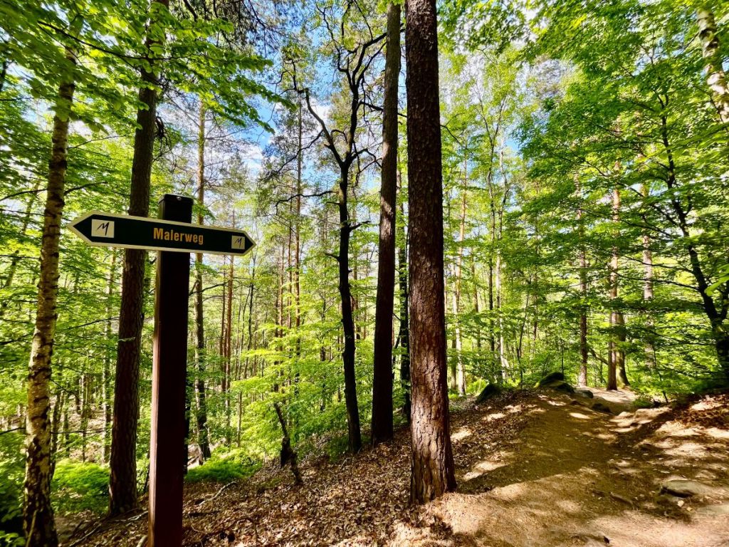
The trail is pretty well waymarked but the sheer number of trails, forestry tracks and other routes through Saxon Switzerland means that you need to keep your wits about you so that you don’t take a wrong turn. You can download the route on your phone using an app such as AllTrails, but we would always recommend taking a paper map with you.
The KOMPASS Wanderkarte 761 includes the national parks on both sides of the German-Czech border and has all the main hiking trails (including the Malerweg) marked. You also get a digital download code when you buy a print edition. You can order the map online, but they are also sold at the tourist information and National Park information centres in Saxon Switzerland, including the one at Bad Schandau station.
There are lots of accommodation options on or close to the trail, from pensions and hotels to campsites and hostels. Bad Schandau has a wide selection of places to stay, while Schmilka (Stages 5 and 6) has become famous as an organic refuge and retreat with overnight accommodation, as well as the aforementioned hot tub filled with beer.
Ferdinands Homestay is a lovely hostel and campsite right on the banks of the Elbe river. It’s not right on the Malerweg trail (although not far away) but it makes for a great basecamp for exploring the region.
If you get accommodation in most places in Saxon Switzerland, you will almost certainly receive (in exchange for paying the local tourism tax) the Saxon Switzerland Guestcard Mobil, which includes the use of public transport throughout the park. This makes it possible to base yourself in one place as you walk the trail, meaning you only need to carry a day pack with you as you go.
Alternatively, you can organise an accommodation plus luggage package for hikes of 4-9 nights along the trail, or individual luggage transfer if you want to organise your accommodation yourself. You can get information on these services (in English) on the Malerweg website.
A nice feature of the trail is that you can download a hiking pass and then collect stamps as you go. You can also collect postcards from the trail (featuring the most famous artworks inspired by the region) from any of the restaurants, hotels and tourist offices that have the stamps – they are certified as “Hiker-friendly along the Malerweg Trail”.
Download your hiking passport here
Finally… if you are coming to Germany from someplace else, it is good to know that in many parts of the country, and in rural areas especially, cash remains king. This often includes accommodation providers in Saxon Switzerland, and even if you can pay for your hotel or hostel in advance or with a card, you will probably need to pay the local tourism tax in cash. Independent restaurants, bakeries, cafes and shops may also be cash-only.
Staying safe
Aside from the normal precautions you should take on any hike or long-distance walk, the main safety notes specific to the Malerweg are around the number of metal ladders and steps that you will need to climb or descend. These can be especially dangerous in wet or icy conditions.
Although the elevation gain is not high by many standards, the trails in Saxon Switzerland can be steep… and tough on the knees! Hiking poles are strongly recommended.
The official Malerweg website from the National Park have advice for hikers on the trail including this equipment list:
- Versatile clothing: even on hot days you might need a light jacket as the gorges are always cool
- Sufficient water and snacks: There are hardly any potable water springs.
- Hiking map/hiking guide: mobile phone reception is not available everywhere
- A small first-aid kit should never be forgotten.
- Bad weather gear to cope with sudden rain or wind
- Cash: not all inns accept card payment
- Identity card or passport, in particular in the area close to the border
- Mobile phone in case of emergencies. Google Maps is absolutely not recommended. We recommend the hiking app Outdooractive.
- Litter bag for a clean environment
- Toilet paper: paper handkerchiefs take a very long time to rot
- Optional items are sun screen, photo camera, seat cushion, hat, binoculars, telescopic hiking poles
The emergency number in Germany is 112. The waymarking signposts along the trail all have a number fixed to the pole behind the sign which is a unique location number in case of emergency. The direct line to the Bergwacht (Mountain Rescue Service) in Kurort Rathen is +49 35024 70447.
Disclaimer:
Outdoor activities, like much of what we do in life, carry risks. Weather can change, accidents can happen and even well-planned adventures can get into difficulty. The information we have provided here and elsewhere on The Winding Trail is based on our personal experience(s) and is intended for general guidance only. We strongly recommend you consult multiple sources, including official trail guides and local authorities. We cannot accept any responsibility for accidents, injuries, damage or loss that may result from following the advice or information contained within this guide.
Stay safe and know your limits.
Would we do it again?
Yes… because we haven’t completed it yet! Our own personal map of the Malerweg still has a couple of stages missing, and it remains a goal to one day complete the trail as a multiday hike. We are also drawn to repeat sections we have already walked because, as mentioned earlier, Saxon Switzerland changes wonderfully with the seasons but because it is not too high in altitude, it is possible to walk these trails at any time of the year.
Added to the fact that we can (and have) done a day on the Malerweg by taking a very early train from Berlin and a (fairly) late one home again in the evening, its accessibility means that if you decide to follow our advice and explore the Malerweg and the other wonderful trails of the region, you never know… if you see us out there, make sure you say hello!
Words and photographs by Paul Scraton
